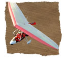
Relieved to be out of the accompanying rotor that came at a price with the extra groundspeed in the rugged mountains, the ground started to flatten out. We passed Inverness airport on our right and they were reporting a 4 knot surface wind. We tracked along the coast past Dornoch, avoiding the Tain range bombing area.
By the time we arrived, the Northerly airfield of Wick had a horizontal windsock and 20 knot bumpy ride in store for us; white caps on the sea told a very different story to the one at Inverness. The wind was blowing straight over the cliffs onto the runway as we landed on 13, making for a very concentrated landing.
It was a relief to be welcomed by Andy Bruce from First North Aviation’s flight school - and it was even better when he allowed us to taxi and park overnight in the cavernous WWII hangar, fully-rigged. It was big enough to store a couple of B-52 bombers, and then some!
GIGHA - PERTH : 12:00 – 13:30
PERTH – WICK : 17:30 – 19:20
Total Flying: 3 hrs 20 mins DAY FIVE
The haze and visibility had been terrible all morning. By the time a small window of opportunity arose at 15:45, we grabbed it and set off over the Pentland firth to the Orkney islands.
We were entering oil rig country now, and I took that to also mean lots of helicopters would be flying around the sky. As I also expected and later discovered, Microlights are not a common occurrence beyond Wick. Up there in the most Northerly islands of the British mainland, ATC sounded surprised to hear us.
The first contact I made with Kirkwall ATC seemed a be frosty one at first when I mentioned the word “Microlight”. We were told to “report start point” by ATC as we passed them.
I read back our start point and planned routing, via the Orkneys, and then across to Fair Isle.
”G-AZ, the start point is some 25km North-East of Kirkwall, report passing”.
Oh. I deduced then, if that wasn’t it, that he must mean the point at which we would start crossing the water to Fair Isle, leaving the land behind us ?
“G-AZ, report position, are you familiar with the local geography?”
I bit my tongue as I took the tone in his voice to be a little acerbic.
“G-AZ abeam North Ronaldsay, 10 minutes to run to start point. 5000ft on 1038, endurance 3 hours, 2 POB”
I was sure that the controller had the cliché’d image most non-flyers seem to have of Microlights. I pictured him visualizing a hang-glider with a lawnmower engine dangling precariously underneath. I also got the impression that he thought we probably wouldn’t have a chart or a planned route, and that were wandering around the sky aimlessly oblivious to IFR traffic flying on instruments.
Once we had reported crossing “Start-Point”, we were handed to Sumburgh radar on 131.3. We left land behind us, flying towards an unfamiliar sight, with only a hazy inversion marking the horizon at 5000ft. |
|


